-
 Dy CM stresses on community driven sustainable tourism
-
 Governor releases book titled ‘Prison Reforms in India’
-
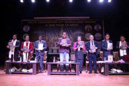
Maiden State Maths Olympiad 2026 held
-
HTE, University faculties participate in workshop on NEP
-
State level Viksit Bharat Youth Parliament held
-
Government reviews fuel supply in Arunachal, situation under control
-
 Founder Trustee of South Asia Women's Network calls on the…
-
 PM releases 22nd PM-KISAN Installment; Arunachal farmers get ₹16.87 Cr…
-
Fire breaks out in hospital canteen, swift action averts major…
-
Trade body, workers union issues ultimatum over pending wages
ITANAGAR, Jun 10:Hands-on training on uses of Monitoring Dashboard and Mobile application for relaying of field information from project sites was imparted to all the District Planning Officers here at Itanagar in the conference Hall of Dept of Planning, Finance and Investment by a team of scientists and engineers from the State Remote Sensing Application Centre.
Speaking on the occasion, Director, State Remote Sensing Application Centre, Harekrishna Dutta informed that Monitoring Dashboard and Mobile application developed for the Planning Department has the unique advantage of repeativity over an area at certain days’ interval, which is utilized under this solution. Even now daily monitoring is possible with the constellation of large number of satellite, he asserted.
Dwelling on the importance of Remote Sensing Technology in planning process, Dutta said the remote sensing images and tools are effective tools for monitoring natural resources and developmental aspects and particular with this solution will change the monitoring scenario of the state.
The solution provided and developed by SRSAC will be of immense use to planners, executing agencies and Government, he further added.
He said the Planning Department can monitor the progress of infrastructure development on the Dashboard, which is combined with geotagged projects and satellite imageries and can be viewed as markers on a map on near real time basis.
While Director, (Monitoring Cell), Department of Planning and Investment, M Ori in his welcome address said, earlier it was very difficult to track the development of projects located at remote places of Arunachal Pradesh.
Lamenting on shortage of manpower for monitoring purpose, Ori said, “We have been depending on third party monitoring system paying huge fees to the consultant firm”. He also added that there was always an apprehension about actual field reporting of developmental activities. However, he was optimistic that the merger of Department of Economics and Statistics Department with the Planning Department would improve manpower scenario in days to come.
Deputy Director, State Remote Sensing Application Centre, Tana Tage speaking on utility of Satellite Based Monitoring and Geotagging Dashboard, said idea behind the development of this solution was based on optimum utilization of space technology for monitoring of developmental projects in this hilly terrain to check unprofessional conduct during the implementation of projects at work sites.
DD, SRSAC, also the nodal officer for the project said it would empower the Planning Department to detect and eliminate duplicity of projects and mismatch of sanctioned amount of projects by comparing satellite images of different dates taken over a period of time to understand change in infrastructure. “The field personnel can travel to project sites to collect photographs and material usages with their smartphones” he said informing that the built in Management Information System can storage information and keep updating on funds allocated and time taken for projects.
He said more importantly this solution will help to get faster site progress compared to resource intensive field visits in regions with terrain that are difficult to traverse.
Earlier, Director, SRSAC, Shri Dutta distributed Case Study report, Manual Users and User Management ID and Passwords to login Monitoring Dashboard to District Planning

Kenter Joya Riba
(Managing Editor)She is a graduate in Science with post graduation in Sociology from University of Pune. She has been in the media industry for nearly a decade. Before turning to print business, she has been associated with radio and television.
Email: kenterjoyaz@easternsentinel.in / editoreasternsentinel@gmail.com
Phone: 0360-2212313